使用期限*
许可形式单机和网络版
原产地加拿大
介质下载
适用平台windows
科学软件网提供大量正版科学软件,满足各学科的科研要求。科学软件网专注软件销售服务已达19年,全国大部分高校和企事业单位都是我们的客户。同时,我们还提供本地化服务,助力中国的科研事业。
构建更大更复杂的模型
Visual MODFLOW Flex具备处理大量详细、高分辨率数据的能力。支持64位系统,您可以利用64位计算机上可用的额外内存,模拟大型复杂的区域尺度地下水系统。
构建可靠的模型
通过集成建模,模型输入和输出可以很*地与原始GIS字段数据一起可视化。这使您可以通过演示如何从概念数据(钻孔记录、地理信息系统数据)生成数值模型数据(模型层、流参数、回灌数据)来建立模型可信度。计算上端和迹线也可以与概念模型数据一起显示,以验证假设并进一步模型可信性。
轻松比较多个模型
Visual MODFLOW Flex的特设计允许简单地比较多个模型,让您评估替代建模方案、网格的不严谨和水文地质解释。
快速上手
提高您的技术知识,并没收成为一个,拥有丰富的学习和支持资源,包括循序渐进的教程、全面的用户指南、视频、在线培训课程和免费的网络研讨会。
2. Define Quadtree Grids (Q-Grids)
3. Refine vertical layers when creating unstructured grids
4. Make use of advanced translation settings providing greater flexibility in how your model simulations are formulated
5. Support for the MODFLOW-USG Ghost Node Correction (GNC) package
6. Flex is now packaged with MODFLOW-USG v1.4, the latest official U*** version as of the release date of Flex 6.0

Define complex geology and model layers using borehole log data and cross-sections
Interpret GIS data to define hydrogeologic properties and boundaries independent of the grid
Run, analyze, and validate model results with raw data in 2D, 3D, and cross-section views
Easily create multiple conceptualizations; generate numerous grids and model scenarios in parallel all in a single project
Assess uncertainty though comparing heads from multiple model runs in 2D, 3D or chart views

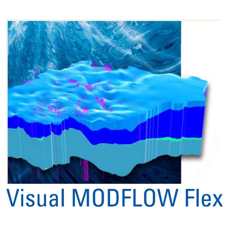
强大的数据可视化功能
新三维可视化技术的构建与设计,Visual MODFLOW Flex 让您的水文地质模型给人印象深刻的视觉效果,并允许您有效地向同事和利益相关者展示和交流您的数据。
可视化所有的数据,包括的2D,3D和多视图(Flexviewer)显示的概念对象、计算网格、数据输入(属性区域、边界条件单元格)和输出数据(计算上端、迹线、水位)
创建切割和横截面视图,并让您在模型中查看
为报表或Web生成3D动画和电影
添加等值线、等高线,迹线和色差到阅读器中
在三维表面上叠加栅格图像(站点地图,卫星图像)以显示浮雕效果
优化OpenGL图形以增强硬件渲染

Concentration output nodes are not always created in RT3D runs
Conceptual BCs assigned to the model sides not assigned as expected following conceptual to numerical model conversion to a finite difference grid if the grid cells are thin and/or there are steep gradients at the model edge.
科学软件网不定期举办各类公益培训和讲座,让您有更多机会免费学习和熟悉软件。
http://turntech8843.b2b168.com