使用期限*
许可形式单机和网络版
原产地美国
介质下载
适用平台Windows
科学软件网提供的软件覆盖各个学科,软件数量达1000余款,满足各高校和企事业单位的科研需求。此外,科学软件网还提供软件培训和研讨会服务,目前视频课程达68门,涵盖34款软件。
Files List and Preview
The Files list, in the middle of the dialog, contains options to open specific files. Click the current file type selection and select the desired file type from the list. Available options are Recent Files, Sample Files, Project Files, and Browse. Select the desired option and the list updates to show all files in the selected type.

Data
Data can be imported from many sources, including ASCII text files, LAS files, and about any database. Strater's internal data structure can contain multiple tables. Multiple boreholes can be stored in the data tables at one time.

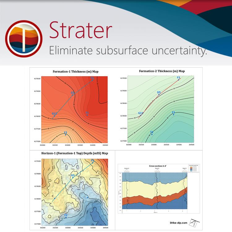
明确地下数据
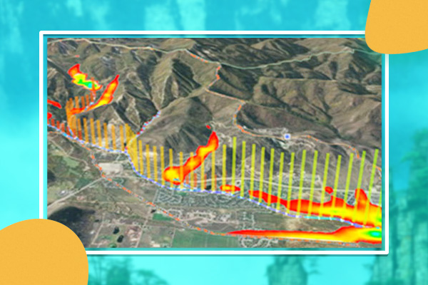
评估和显示地质数据的各个方面。轻松创建岩性条形测井、线测井或光栅测井的横截面,以便更好地理解深度数据的细节。大化您的理解,这样您每次都能做出好的决定。
增强地质模型
好地表示数据。显示地下数据与Strater的众多定制选项。实际上,Strater的日志、模型和横截面的每个方面都是可定制的。
Strater自定义选项
包括标题、轴、标尺和图例
绘制文本、折线、多边形、符号和样条折线
应用基于行业标准的预定义或自定义填充模式
根据需要使用工具对齐、覆盖或分发日志
生成可与同事共享和跨多个项目重用的自定义填充库
创建标准化模板来创建一致的报告
包括定制的页眉和页脚
Strater横截面定制选项
将任何类型的日志添加到现有的横截面
定义和定制岩性地层
显示偏离或垂直的日志
使用scheme可以快速应用符号、填充和行属性,并将它们保存为跨多个项目使用
在横截面上显示水位
使用Voxler集成命令将截面转换为3D栅栏图
添加井头以显示井眼信息,以及井**或井底之间的距离
在适当的高度悬挂原木

产品功能
创建的测井曲线和井眼模型
发现数据的深度。Strater将地下数据转换成可理解的测井曲线和井眼模型。更好地理解您的数据,这样您每次都可以做出明智的决策。
Strater日志类型
深度 岩石学 发布 井建设
线/符号 区域状态栏 分类发布 栅格
综合图表 状态栏 图形 图表
功能 百分比 复杂文本 蝌蚪
Line/Symbol Logs
Display your depth data as a graph! Line/symbol logs can be useful for displaying assay values, geophysical parameters, moisture content, etc. You can wrap line/symbol logs with multiple styles: truncate, custom wrap, wrap at a 10X scale, or wrap at a 100X scale.
科学软件网为全国大多数高校提供过产品或服务,销售和售后团队,确保您售后**!
http://turntech8843.b2b168.com