使用期限租赁和*
许可形式单机和网络版
原产地美国
介质下载
适用平台windows
科学软件网销售软件达19年,有丰富的销售经验以及客户资源,提供的产品涵盖各个学科,包括经管,仿真,地球地理,生物化学,工程科学,排版及网络管理等。此外,我们还提供很多附加服务,如:现场培训、课程、解决方案、咨询服务等。
Vector And GIS Output Formats
Output Complete Models as C Tech 4D Interactive Models (4DIM)
Output Complete Models as VRML (type 1 and 2)
Output Any Object as a 3D ESRI Shapefile or a 3D DXF File

EVS Pro 集成了
钻井的定址、已有的钻井和测量数据的分析;
**场所的地质观测;
三维建筑的定址和轮廓的勾绘;
道路选址、地形的分析等;
航空影像的处理分析;
土壤的污染分析;
地下水的污染分析;
地下水流分析;
湖泊、河流和海洋数据的处理分析;
空气和噪音污染的等级分析。
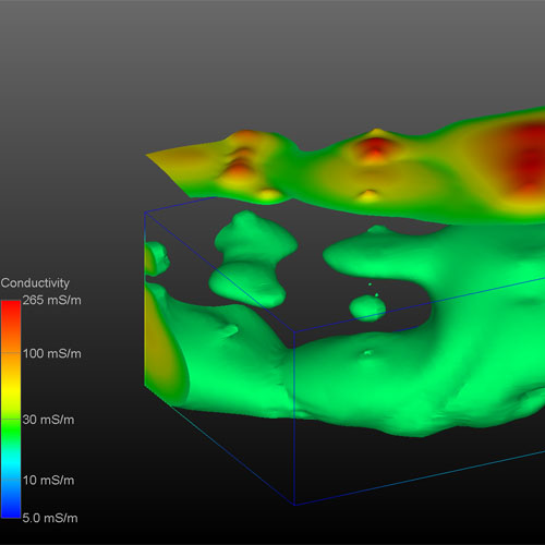
体绘制
EVS Pro的体绘制提供了代表污染物羽流的另一种完全三维可视化技术。
区域切割和透明度
EVS Pro的区域切割功能和透明功能被用来创建三维可视化同时展示沿着建筑物轮廓向下方向污染的不同的等级。相应的五个地质单元的污染状况展示了每一个土层的污染等级状况。
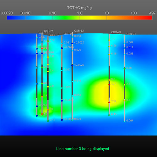
交互式栅栏图
EVS Pro提供了通过在真三维物体上生成切片,然后交互创建栅格图并进一步描述化学和地质概况。
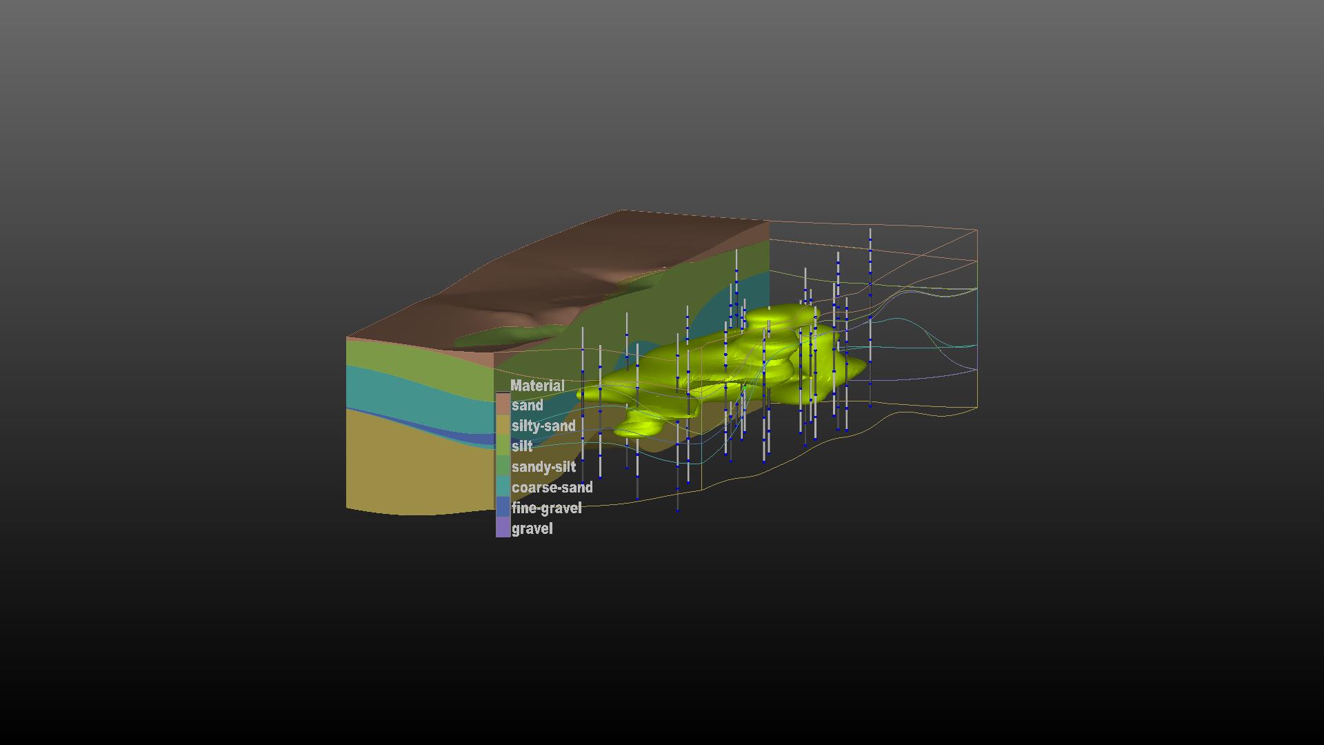
Mining Visualization System (MVS)是C Tech的分析和可视化的旗舰产品。MVS是从地面向地下和地表开采满足分析要求而设计的。然而,它所使用的工具也是土木和的环境建模。MVS EVS-PRO构建所有的功能,并增加了强大的新功能针对矿业的需求,满足规划师、土木、地质学家和环境苛刻的要求。
MVS的一些特的特性包括:3D断块代;矿体和羽流表土建模;隧道切割;矿井建模;许多额外的特性。
地质统计学功能
MVS地质统计学模块被用来估计黄金浓度使用所有可用的分析数据。所有地区的非盟级以上30磅的显示,根据地层学与矿色。

Earth Volumetric Studio includes the capabilities of C Tech’s former Environmental Visualization System Pro and MVS (Mining Visualization System) within a more powerful, easy-to-use environment. Features include: borehole and sample posting; parameter estimation using expert system driven 2D and 3D kriging algorithms with best fit variograms; exploding geologic layers; finite difference and finite element modeling grid generation; advanced gridding; comprehensive Python scripting of virtually all functions; high level animation support; interactive 3D fence diagrams; multiple analyte data analysis and integrated volumetrics and mass calculation for soil and groundwater contamination and ore bodies. The advanced features in , formerly found in our MVS software are targeted to the needs of mining engineers and planners, or the geologist or environmental engineer with the most demanding requirements. Some of the advanced features include: 3D fault block generation; tunnel cutting; advanced texture mapping; mine pit modeling; visualizing and modeling of ore body overburden; and many additional advanced features.
Studio includes C Tech’s DrillGuide© technology which applies integrated geostatistics to provide quantitative appraisal of the quality of site assessments and identification of optimal new sample locations at sites that require additional investigation. This proven technology can dramatically cut site assessment costs whether you’re searching for gold or groundwater contamination. Our tools improve site assessment and enhance your ability to analyze and present data for assessments, remediation planning, litigation support, regulatory reporting, and public relations.
Earth Volumetric Studio
Earth Volumetric Studio (Studio) is the revolutionary synthesis of C Tech’s Environmental Visualization System and Mining Visualization System integrated with new technology from years of EnterVol development. Earth Volumetric Studio retains the modular toolkit paradigm of its predecessors in an updated, user friendly environment.
科学软件网不仅提供软件产品,更有多项附加服务免费提供,让您售后**!
http://turntech8843.b2b168.com