使用期限租赁和*
许可形式单机和网络版
原产地美国
介质下载
适用平台windows
科学软件网销售软件达19年,有丰富的销售经验以及客户资源,提供的产品涵盖各个学科,包括经管,仿真,地球地理,生物化学,工程科学,排版及网络管理等。此外,我们还提供很多附加服务,如:现场培训、课程、解决方案、咨询服务等。
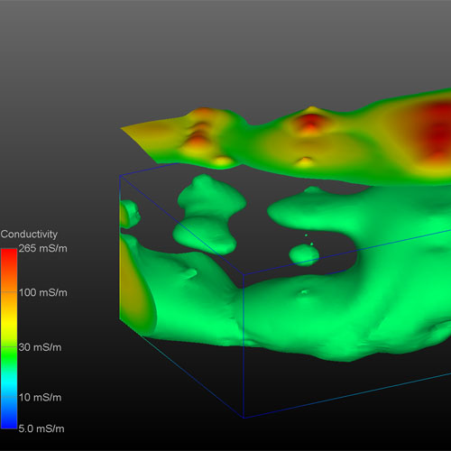
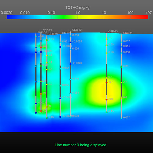
矿体和污染羽状物
MVS重要的功能之一是计算矿体或污染羽表土。使用它,您可以快速确定提取柱所需的坑。地球物理参数如坑壁坡度和挖掘精度的计算。
复杂的三维建模
MVS能够模拟复杂的地形学的关系。断层、地垒、地堑、褶皱复杂的三维模型,盐丘和其他许多复杂的地质结构使用MVS很*创建。

Visualization Techniques
User Definable Color Mapping (Symbology)
Solid Colored Contours and Gouraud Shading
Georeferenced Texture Mapping of Aerial Photos onto Any Object
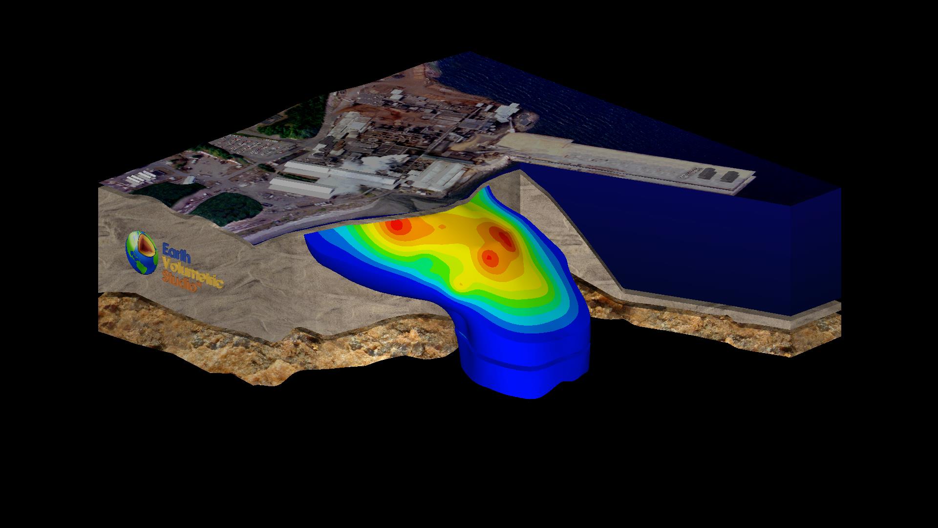
Image Files (all formats) to Use as Texture Maps (overlays)
ArcGIS
U*** SDTS and DEMs
ArcGIS
ESRI Shapefiles (ARC/INFO®, ArcGIS®, and ArcView®)
ArcGIS
C Tech 4D Interactive Models (4DIM) Playback

2D & 3D Isolines and Contours
3D Labeled Isolines
Arbitrary or Orthogonal Plane Cutting
Rotated Rectangle or Cylinder Coring
Interactive 3D Fence Diagrams Thin
Interactive 3D Fence Diagrams Thick
科学软件网专注提供正版软件,跟上百家软件开发商有紧密合作,价格优惠,的和培训服务。
http://turntech8843.b2b168.com