使用期限*
许可形式单机和网络版
原产地美国
介质下载
适用平台Windows
科学软件网提供大量正版科学软件,满足各学科的科研要求。科学软件网专注软件销售服务已达19年,全国大部分高校和企事业单位都是我们的客户。同时,我们还提供本地化服务,助力中国的科研事业。
明确地下数据
评估和显示地质数据的各个方面。轻松创建岩性条形测井、线测井或光栅测井的横截面,以便更好地理解深度数据的细节。大化您的理解,这样您每次都能做出好的决定。

Top-Down View
Create top-down maps to view well log and borehole information in the correct geographic context.

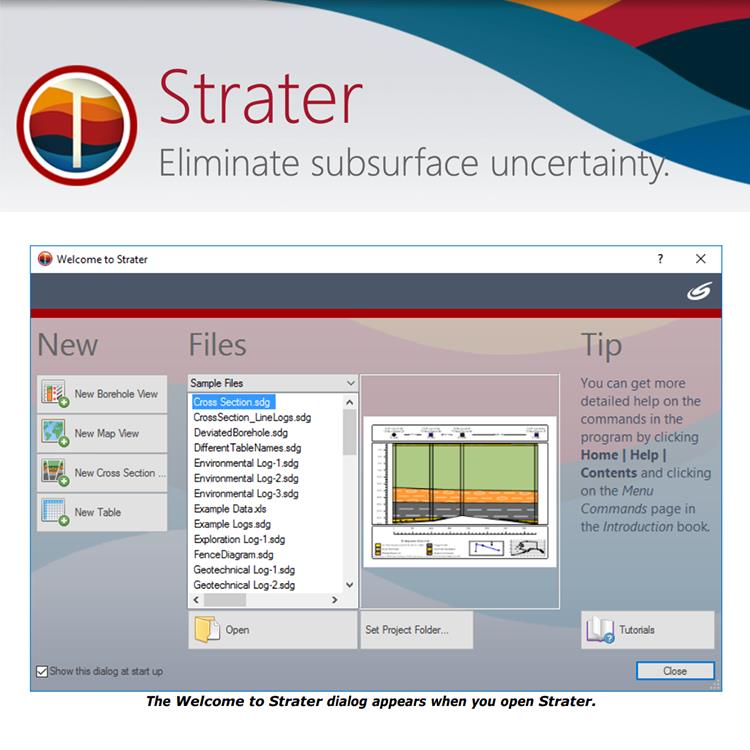
Open
After clicking on a file in the file type list, click the Open button to open the selected file. The Welcome to Strater dialog closes and the action is performed. The Open button is disabled until a file is selected in the Files list. To open a file that is not located in any of the lists select Browse in the file type list.

Create standardized templates to create consistent reports
,专注,专心是科学软件网的服务宗旨,开发的软件、传递*的技术、提供贴心的服务是我们用实际行动践行的**目标,我们会为此目标而不懈努力。
http://turntech8843.b2b168.com