使用期限*
许可形式单机
原产地美国
介质下载
适用平台windows
科学软件网提供大量正版科学软件,满足各学科的科研要求。科学软件网专注软件销售服务已达19年,全国大部分高校和企事业单位都是我们的客户。同时,我们还提供本地化服务,助力中国的科研事业。
Supported server types:

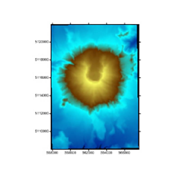
Collaborate with Confidence
Quickly share your work with colleagues, stakeholders, and clients. Surfer models are ready for printed publication with the high quality export formats including PDF or TIF. Alternatively, share your work online with web compatible formats like JPG or PNG. If you are preparing for a presentation, simply copy and paste your map or model into presentation tools such as Microsoft PowerPoint or Word.

Surfer 2D/3D测绘、建模分析软件

Make Meaningful Decisions
Get answers to your questions with Surfer’s geoprocessing tools. Process your data and analyze relationships. Narrow down areas of interest, highlight important intersections, or perform mathematical calculations on the underlying data to make informed decisions.
Surfer Geoprocessing Tools
View, create, edit and delete object attributes using the convenient Attribute Table
Calculate attribute values
Query objects based on attribute values
Perform Delaunay triangulation
Reshape, simplify, smooth polylines, polygons, and grids
Create buffers around points, polylines, and polygons
Convert between polygons and polylines
Create polygons by combining existing polygons
Create points or polygons in intersecting areas
Connect or break polylines at specified locations
Combine and split islands
Georeference images
Crop images
Set a color in an image to be transparent
2020年,北京天演融智软件有限公司申请高等教育司产学合作协同育人项目,“大数据”和“机器学习”师资培训项目,以及基于OBE的教考分离改革与教学评测项目已获得批准。我们将会跟更多的高校合作,产学融合协同育人。
http://turntech8843.b2b168.com