使用期限*
许可形式单机
原产地美国
介质下载
适用平台windows
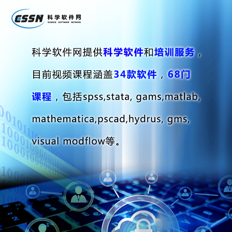
科学软件网提供的软件覆盖各个学科,软件数量达1000余款,满足各高校和企事业单位的科研需求。此外,科学软件网还提供软件培训和研讨会服务,目前视频课程达68门,涵盖34款软件。
创建的地图
轻松沟通简单和复杂的空间数据。Surfer提供创建高质量地图工具,可以清楚的向同事、客户和利益相关者传统信息。
Surfer Map Types
Contour
Base
Post
3D Surface
Color Relief
Classed Post
3D Wireframe
Peaks and Depressions
1-Grid Vector
2-Grid Vector
Watershed
Grid Value
Viewshed
Point Cloud

Surfer 软件 美国Golden Software 公司编制的一款以画三维图(等高线,image map, 3d surface)的软件。该软件简单易学,可以在几分钟内学会主要内容,且其自带的英文帮助(help菜单)对如何使用该软件解释的很详细,其中的tutorial教程更是清晰的介绍了surfer的简单应用。
Surfer 具有的强大插值功能和绘制图件能力,使它成为用来处理XYZ数据的软件,是地质工作者*的成图软件。可以轻松制作基面图、数据点位图、分类数据图、等值线图、线框图、地形地貌图、趋势图、矢量图以及三维表面图等;提供11种数据网格化方法,包含几乎所有流行的数据统计计算方法;提供各种流行图形图像文件格式的输入输出接口以及各大GIS软件文件格式的输入输出接口,大大方便了文件和数据的交流和交换;提供新版的脚本编辑引擎,自动化功能得到较大加强。
主要功能
1、等高线的绘制
2、在等高线图上加背景地图
3、图件白化(blank)
4、数据文件统计功能
5、粘贴和分类粘贴子图
6、生成向量图
7、图形输出
8、功能:用函数直接作图、标注文字、画简单的图形等。
图形规格与种类:
--Contour Maps 可做等高线图,结果可输出成3D DXF
--3D Wireframe Maps 可做三维网格图
--3D Surface Maps 可做三维表面图
--Post Maps 可做三维张贴图文字标注
--Shaded Relief Maps 可做阴影图,具有相片质量.
--Image Maps 可做影像图, 可以做细腻的色阶处理
--Vector Maps 可做向量图,
--Base Maps 可输入底图以便搭配3D图型
--Overlap Maps 可将图型重叠
--Overlap Maps 可将地面影像图与3D Surface重叠
--Gridding 可选择多种方格化功能
--Output 图型输出可选CGM、DXF、BMP、GIF、EPS、HPGL等
--Worksheet 数据输入可用Lotus、Excel、ASCII
--Text 文字可用上下标、数学符号、线型符号、颜色都可定义
--可以和Grapher搭配,将剖面结果输出成Grapher之XY图形

Make Meaningful Decisions
Get answers to your questions with Surfer’s geoprocessing tools. Process your data and analyze relationships. Narrow down areas of interest, highlight important intersections, or perform mathematical calculations on the underlying data to make informed decisions.
Surfer Geoprocessing Tools
View, create, edit and delete object attributes using the convenient Attribute Table
Calculate attribute values
Query objects based on attribute values
Perform Delaunay triangulation
Reshape, simplify, smooth polylines, polygons, and grids
Create buffers around points, polylines, and polygons
Convert between polygons and polylines
Create polygons by combining existing polygons
Create points or polygons in intersecting areas
Connect or break polylines at specified locations
Combine and split islands
Georeference images
Crop images
Set a color in an image to be transparent
19年来,公司始终秉承、专注、专心的发展理念,厚积薄发,积累了大量的人才、技术以及行业经验,在行业内得到了大量用户的认可和高度价。
http://turntech8843.b2b168.com