使用期限*
许可形式单机
原产地美国
介质下载
适用平台windows
科学软件网是一个以引进国研软件,提供软件服务的营业网站,网站由北京天演融智软件有限公司创办,旨在为国内高校、科研院所和以研发为主的企业事业单位提供的科研软件及相关软件服务。截止目前,科学软件网已获得数百家国际软件公司正式授权,代理销售科研软件达一千余种,软件涵盖领域包括经管,仿真,地球地理,生物化学,工程科学,排版及网络管理等。同时,还提供培训、课程(包含34款软件,66门课程)、实验室解决方案和项目咨询等服务。
Surfer 2D/3D测绘、建模分析软件
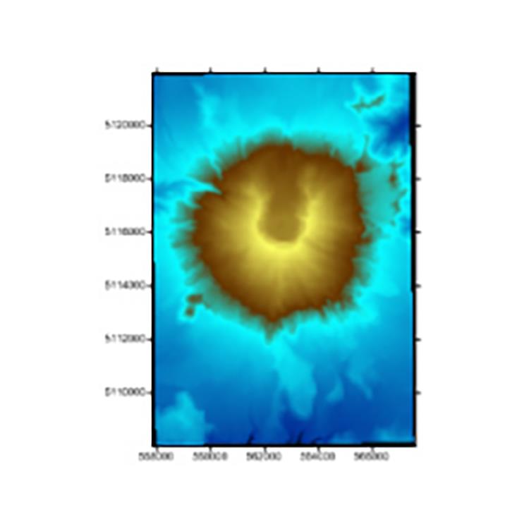
可视化数据
使用Surfer广泛的建模工具以正确的方式显示数据,同时保持准确性和性。用Surfer可以明确的传达您的信息。
LiDAR点云
LiDAR在许多领域,包括考古学、测量学、地理信息系统等成为越来越流行的数据收集方法。使用Surfer广泛的激光处理和可视化功能,利用LiDAR提供的所有优势。
LiDAR点云功能
从多个LAS/LAZ文件中创建一个点云
通过高程、强度、返回数或分类来分配颜色
交互式或按标准选择点
、重分类或删减来选择点
从点云中创建网格或导出到LAS/LAZ
在3D视图中可视化数据的所有方面
Surfer的LAS/LAZ过滤选项
基于XY边界或高程数据限制的空间滤波
导入每个Nth点
只导入期望的返回类型或分类值
用源ID导入数据
标志过滤器,如扫描方向、飞行边缘,或合成、关键和保留点。
Export Map and Drawn Objects in One Step
Save time! Exporting map and non-map objects got a lot easier. No more complicated two-step export process. Now, simply specify the map as the scaling source when exporting your entire project to a vector or georeferenced image file– it’s that easy!

Surfer用户界面的功能特征
欢迎对话框开始您的工作
地图向导快速让您生成地图和模型
自定义色带和快速访问工具栏
所有窗口停靠或浮动
单个窗口查看、编辑和操作数据和地图
内容窗口轻松管理图层和模型的图层
用于快速编辑功能的属性窗口
工作表窗口查看或编辑原始数据

Work Seamlessly with all Coordinate Systems
Your job is to transform data into valuable visualizations. Surfer’s job is to make it easy for you. Surfer effortlessly manages unreferenced data and data projected in different/multiple coordinate systems. It really is that easy.
Surfer Coordinate System Features
Over 2500 predefined coordinate systems
Create custom coordinate systems
Search coordinate systems by name or EPSG number
Reproject coordinate systems
Over 80 ellipsoids
Over 45 predefined linear units
Create custom linear units
Add graticule or grid lines to view different coordinate systems on a map

Surfer Interpolation Features
Variogram models
Anisotropy
Kriging with external drift
Faults and breaklines
Control over search neighborhood size, shape, and constraints
Data filtering
Automatic data statistics
19年来,公司始终秉承、专注、专心的发展理念,厚积薄发,积累了大量的人才、技术以及行业经验,在行业内得到了大量用户的认可和高度价。
http://turntech8843.b2b168.com