使用期限*
许可形式单机
原产地美国
介质下载
适用平台windows
科学软件网提供大量正版科学软件,满足各学科的科研要求。科学软件网专注软件销售服务已达19年,全国大部分高校和企事业单位都是我们的客户。同时,我们还提供本地化服务,助力中国的科研事业。
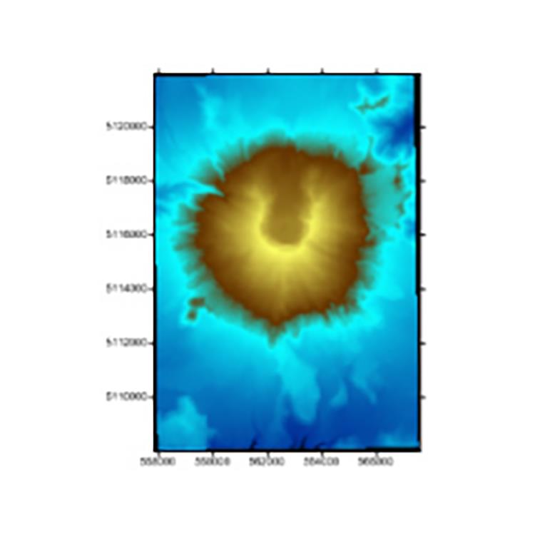
Edit Contours
Edit contour lines down to the finest detail. Surfer’s grid editor lets you quickly adjust contour lines by interactively editing the underlying grid file. Brush, warp, smooth, push down or up, and erase grid nodes, and immediately see the changes to your grid-based maps.
Perform free-hand contour editing
Brush specific Z values across nodes
Smooth contours
Pull up or push down contours in specific areas
Warp contour lines
Erase parts of the contour map
Find the Z value at any XY point location

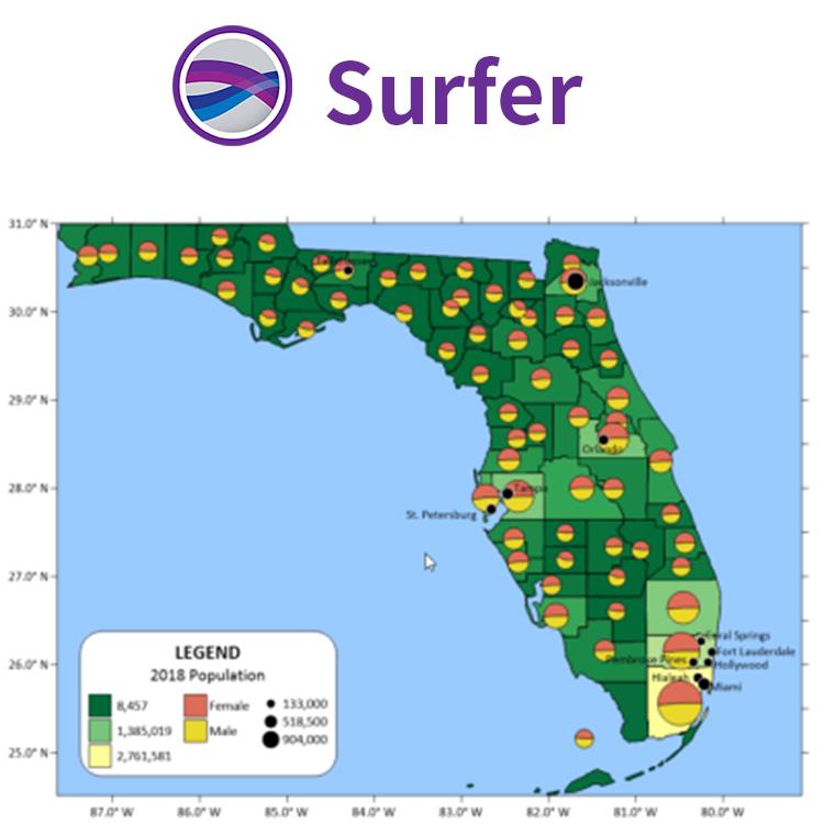
Surfer 2D/3D测绘、建模分析软件
可视化数据
使用Surfer广泛的建模工具以正确的方式显示数据,同时保持准确性和性。用Surfer可以明确的传达您的信息。
LiDAR点云
LiDAR在许多领域,包括考古学、测量学、地理信息系统等成为越来越流行的数据收集方法。使用Surfer广泛的激光处理和可视化功能,利用LiDAR提供的所有优势。
LiDAR点云功能
从多个LAS/LAZ文件中创建一个点云
通过高程、强度、返回数或分类来分配颜色
交互式或按标准选择点
、重分类或删减来选择点
从点云中创建网格或导出到LAS/LAZ
在3D视图中可视化数据的所有方面
Surfer的LAS/LAZ过滤选项
基于XY边界或高程数据限制的空间滤波
导入每个Nth点
只导入期望的返回类型或分类值
用源ID导入数据
标志过滤器,如扫描方向、飞行边缘,或合成、关键和保留点。
Export Map and Drawn Objects in One Step
Save time! Exporting map and non-map objects got a lot easier. No more complicated two-step export process. Now, simply specify the map as the scaling source when exporting your entire project to a vector or georeferenced image file– it’s that easy!

Immediate Access to Online Data
An abundance of data is at your fingertips waiting to be visualized. Surfer gives you immediate access to worldwide aerial imagery, Open Street Map imagery, worldwide vector data, and terrain data. If you have your own favorite data servers or access to a private data server, include a custom link to that source for easy access. Surfer makes it easy to access the surplus of online data.
Supported server types:
Web mapping server (WMS)
Open Street Map server (OSM)
Web coverage server (WCS)
Web feature server (WFS)

Surfer符号
根据属性值应用行、填充和 符号属性
图例中显示符号
基于特的值选择符号,未归类的颜色和符号和归类的颜色和符号。
即时访问联机数据
Surfer可以让您立即获得**航空影像、开放的街道地图图像、**矢量数据和地形数据如果您有自己喜欢的数据服务器或访问私有数据服务器,请为该数据源包含一个自定义链接以方便访问。Surfer可以很*地访问在线数据的剩余部分。
支持的服务器类型:
网络地图服务器(WMS)
开放的街道地图服务器(OSM)
网络覆盖服务器(WCS)
网络功能服务器(WFS)
与所有坐标系统无缝地协同工作
您的工作是将数据转换为有价值的可视化,而Surfer的功能是将您的工作变得更简单。Surfer轻松管理未引用的数据和数据在不同的多坐标系统投影。
Export all your data! Export a contour map to MIF, SHP, GSB, GSI, BLN or BNA file formats and the Z values are stored as metadata. In addition,when exporting a contour map to KML file, the Z values of the contours are saved as the Object ID for the polyline objects.
科学软件网为全国大多数高校提供过产品或服务,销售和售后团队,确保您售后**!
http://turntech8843.b2b168.com