使用期限*
许可形式单机
原产地美国
介质下载
适用平台windows
科学软件网提供的软件上千款,涉及所有学科领域,您所需的软件,我们都能提供。科学软件网提供的软件涵盖领域包括经管,仿真,地球地理,生物化学,工程科学,排版及网络管理等。同时,还提供培训、课程(包含34款软件,66门课程)、实验室解决方案和项目咨询等服务。
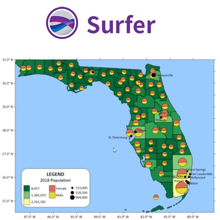
可视化数据
使用Surfer广泛的建模工具以正确的方式显示数据,同时保持准确性和性。用Surfer可以明确的传达您的信息。
分析数据
用Surfer众多的分析工具深度分析您的数据。调整插值和网格参数,评估数据与函数空间的连续性,定义故障和断线,或执行网格计算,如卷、变换、平滑或滤波。Surfer快速将数据转化为知识。
结果说明
自信的传达您来之不易的发现。无论是项目经理、论题顾问还是客户,Surfer有助于全面透彻地理解数据。
信任自1983年
Surfer经受住了时间的考验。成千上万的科学家和信任Surfer来展示他们的数据。
Surfer适用的行业包括
农业
考古
建筑
教育
能源
环境
勘探
地球物理
程
地热
地理信息系统
海事
军事
采矿
泥浆录井
石油与天然气
可再生能源
无人机
公共事业
水利

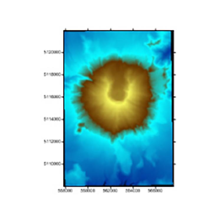
Create Professional Maps
Easily communicate both simple and complex spatial data. Surfer gives you the tools to create high-quality maps to clearly deliver your message to coworkers, clients, and stakeholders.
Surfer Map Types
Contour
Base
Post
3D Surface
Color Relief
Classed Post
3D Wireframe
1-Grid Vector
2-Grid Vector
Watershed
Grid Value
Viewshed
Point Cloud

Enhance Maps & Models
Surfer gives you the tools to visualize and model all types of data, but it doesn’t stop there. Surfer’s extensive customization options allow you to convey complex ideas in an easy to understand manner. Enhance your maps and models with a variety of customizations options.
Surfer Customization Options
Add legends, cross sections, magnifiers, scale bars, and multiple axes
Include headers and footers
Apply linear or logarithmic color scales
Adjust tilt, rotation, and field of view angle
Edit all axis parameters
Include graticule lines or another grid
Combine or stack multiple maps
Define custom line styles and colors
Edit text, line, fill and symbol properties
Add text, polylines, polygons, symbols, and spline polylines
Include range rings
Many more…

Make Meaningful Decisions
Get answers to your questions with Surfer’s geoprocessing tools. Process your data and analyze relationships. Narrow down areas of interest, highlight important intersections, or perform mathematical calculations on the underlying data to make informed decisions.
Surfer Geoprocessing Tools
View, create, edit and delete object attributes using the convenient Attribute Table
Calculate attribute values
Query objects based on attribute values
Perform Delaunay triangulation
Reshape, simplify, smooth polylines, polygons, and grids
Create buffers around points, polylines, and polygons
Convert between polygons and polylines
Create polygons by combining existing polygons
Create points or polygons in intersecting areas
Connect or break polylines at specified locations
Combine and split islands
Georeference images
Crop images
Set a color in an image to be transparent
科学软件网不定期举办各类公益培训和讲座,让您有更多机会免费学习和熟悉软件。
http://turntech8843.b2b168.com