使用期限*
许可形式单机和网络版
原产地美国
介质下载
适用平台windows
科学软件网是一个以引进国研软件,提供软件服务的营业网站,网站由北京天演融智软件有限公司创办,旨在为国内高校、科研院所和以研发为主的企业事业单位提供的科研软件及相关软件服务。截止目前,科学软件网已获得数百家国际软件公司正式授权,代理销售科研软件达一千余种,软件涵盖领域包括经管,仿真,地球地理,生物化学,工程科学,排版及网络管理等。同时,还提供培训、课程(包含34款软件,66门课程)、实验室解决方案和项目咨询等服务。
But don't take our word for it
Take the word of the hundreds of scientists and engineers who have cited GS+ in their research publications – over 100 in 2017 alone. Or the hundreds of users at universities, government and non-governmental research institutes, and various industries in almost every country in the world.

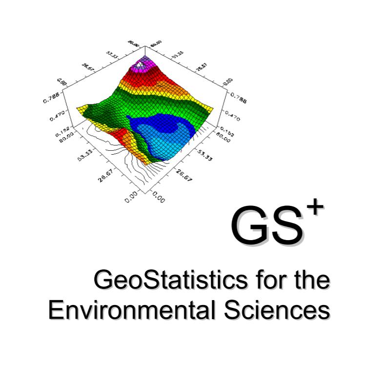
GS+ 环境科学地质统计学软件
概述
GS+软件于1988年作为个针对个人电脑和工作站的综合地理统计程序被引入。它很快成为**用户使用的地理统计程序。广受**的是,GS+是个通过集成包提供半方差分析的地理统计软件,它提供了所要求的灵活性和新手所欣赏的简单性。GS+支持从Windows 7到10的操作系统。
今天GS+仍然是地球和环境科学的的2D地理统计软件。它在世界范围内被工业、机构和学术研究人员使用。GS+已被用于数百项空间分析的科学研究。而那些通过ESRI和其他GIS供应商提供GIS软件包的用户更喜欢GS+,因为它可以更全面地访问复杂的分析。输出的文件,可以很*地将导入到GIS数据库和地图中。
快速执行地理统计分析
地理统计学提供了一种方法,可以更好地理解空间数据中固有的自相关,并定义和使用这种变化,以便更好地估计未被采样的地方的值,从而创建优、无偏离的地图。GS+提供了对这些计算密集型分析的简单访问。无论您是在分析石油沉积物、浮游生物分布、太阳黑子模式、性疾病爆发或土壤资源,GS+都能让您随时掌握地质统计学的功能。
创建变异函数
GS+使您可以完全控制变差函数参数,如主动滞后距离和个体滞后类的大小。默认值提供了合理的起点,您可以优化分析以适应特定的数据集。
自动创建变差函数模型---可以自动创建kriging模型,大程度地使用迭代技术来优化您的数据,以优化良好的模型拟合。模型窗口允许您覆盖GS+选择的值,滑动条控件允许您立即看到更改的结果。GS+为几乎所有的kriging应用程序提供足够的模型。
由于数据异常,变差函数有时是不规则的---当它们是的值时,它们就会变得很明显,而不是与其他值在特定的范围内自动关联。GS+提供了h散射图和方差云分析,使您能够快速地可视化和识别异常值,并且新的掩饰命令允许您像手术一样移除(暂时或地)违规数据记录。定向变异(各向)函数是同时产生的各向同性的变量,所以您可以很*地评估自相关是否依赖于罗盘的方向。例如,当存在一个斜率效应或其他环境特征时,在一个方向上的自相关与另一个方向的自相关是不同的。
GS+ means geostatistics
Geostatistics is not an add-on feature of GS+ – it is the heart of the software. Many of our users have access to other geostatistics tools within their favorite GIS or mapping programs, but come to GS+ for their serious geostatistical analyses. Because GS+ output is compatible with industry standards, GS+ can be used directly with many of these other programs. Or it can be used standalone – GS+ has its own data worksheet (which also accepts Excel, Access, and other types of data files) and produces its own maps.
About Gamma Design Software, LLC
Gamma Design Software was started in 1988 to bring geostatistics to Windows workstations and desktop computers. At that time fast geostatistics software was available only for supercomputers, and other users needed to compile FORTRAN source code on their own. Since then, Gamma Design has been a world leader in providing accessible, powerful, and easy-to-learn geostatistics software for the evolving Windows environment.

GS is compatible with modern Windows platforms (see system requirements) and accepts data files with as many as 2 billion records. Algorithms are fast and dependable. Geostatistical analysis is computationally intensive – prior to 1988 most analyses had to be performed on supercomputers, but GS allows the Windows environment to handle most data sets with ease. Written in a combination of Visual Studio and Fortran, and drawing on GSLIB subroutines, GS shows that computation speed, flexibility, and an intuitive interface are compatible.

Frequency distributions provide information about the normality of a particular data analysis set.
科学软件网不仅提供软件产品,更有多项附加服务免费提供,让您售后**!
http://turntech8843.b2b168.com