使用期限租赁和*
许可形式单机和网络版
原产地美国
介质下载
适用平台windows
科学软件网提供的软件上千款,涉及所有学科领域,您所需的软件,我们都能提供。科学软件网提供的软件涵盖领域包括经管,仿真,地球地理,生物化学,工程科学,排版及网络管理等。同时,还提供培训、课程(包含34款软件,66门课程)、实验室解决方案和项目咨询等服务。
Analytical And Statistical Capabilities
DrillGuide©
Computation of Ore Body Plume Overburden Mass and Volume
Integrated Volumetrics & Contaminant/Ore Body Mass
Statistical Analysis of Input Data Files
Statistical Analysis of 3D Models

EnterVol GeoStats
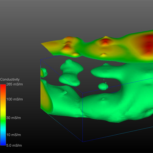
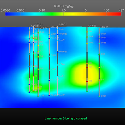
EnterVol GeoStats© provides the ability to create volumetric grids and perform parameter estimation into those volumes. Using the same technology in C Tech’s EVS & MVS software, our expert systems will guide you through the process of performing 2D and 3D volumetric estimation using Kriging and inverse distance weighted.
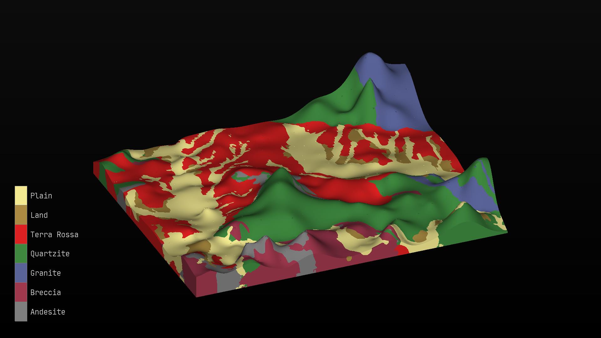
Earth Volumetric Studio环境可视化和挖掘可视化系统
Earth Volumetric Studio是Environmental Visualization System和Mining Visualization System,结合多年EnterVol开发的一个革命性的集成软件。Earth Volumetric Studio在更新的,友好的用户环境中保留了之前版本的模块化工具包范例。Earth Volumetric Studio是一个立的Windows程序,它可以提供的运行速度、功能和灵活性。Studio了的体积网格,地球统计分析和4D可视化工具,应用于所有地球科学学科。图形用户界面集成了模块化分析和图形例程,可以定制和组合,以满足任何应用程序的分析和可视化需求。Studio可以用来分析任何环境中所有类型的分析和地球物理数据。(如土壤、地下水、地表水、空气、噪音、电阻率等)。Earth Volumetric Studio的综合地质统计学提供了对数据和站点模型质量的定量评估,并确定需要额外数据收集的位置。
C Tech’s software is used by government agencies, universities and companies around the world. Our customers include the United Nations, U.S. Environmental Protection Agency, Environment Canada, U.S. Geological Survey, British Geological Survey, U.S. Army Corps of Engineers, U.S. Department of Energy Laboratories, U.S. Nuclear Regulatory Commission, U.S. Department of Transportation, and the majority of the world’s largest engineering and environmental consulting firms.
Environmental database and data management software products such as Microsoft Excel & Access, ESRI’s ArcView, ArcINFO and ArcGIS, gINT Professional and EarthSoft’s EQuIS, & EScIS’ ESdat are also supported.
More complex gridding capabilities are available in EnterVol Geology©. When both EnterVol GeoStats and EnterVol Geology are installed on the same system, 3D estimation into geologic models is possible.
科学软件网不仅提供软件产品,更有多项附加服务免费提供,让您售后**!
http://turntech8843.b2b168.com