使用期限*
许可形式单机版
原产地美国
介质下载
适用平台Windows
科学软件网提供的软件覆盖各个学科,软件数量达1000余款,满足各高校和企事业单位的科研需求。此外,科学软件网还提供软件培训和研讨会服务,目前视频课程达68门,涵盖34款软件。
LCM
The Land Change Modeler has undergone a major revision:
LCM includes three new empirical modeling tools – Support Vector Machine (SVM), Decision Forest (an implementation of Random Forest) and Weighted Normalized Likelihood (WNL). The latter is capable of modeling large numbers of transitions in a rapid time frame.
We have also added the option to use a balanced sample with Logistic Regression, yielding transition potentials more in line with those produced by procedures such as LCM’s Multi-Layer Perceptron (MLP).
Revised to allow the automatic modeling of multiple transitions for all procedures, with the exception of SimWeight.
Adds the ability to quickly add all transitions to a single group, or to ungroup them and use automatic transition names.
Greatly improved control of project flow.

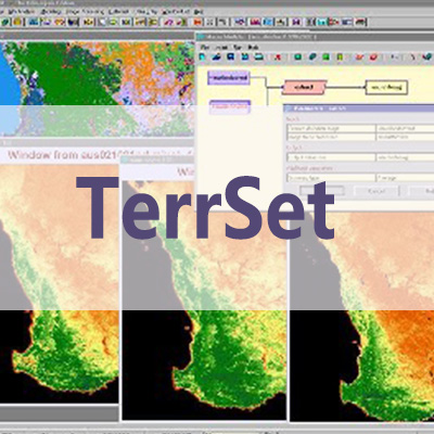
What’s New – TerrSet 2020
Now in its 33rd year of development, Clark Labs continues to improve and extend the TerrSet suite of geospatial monitoring and modeling tools. Key developments include:

Earth Trends Modeler
The Earth Trends Modeler (ETM) is an integrated suite of tools for the analysis of image time series data associated with Earth Observation remotely sensed imagery.

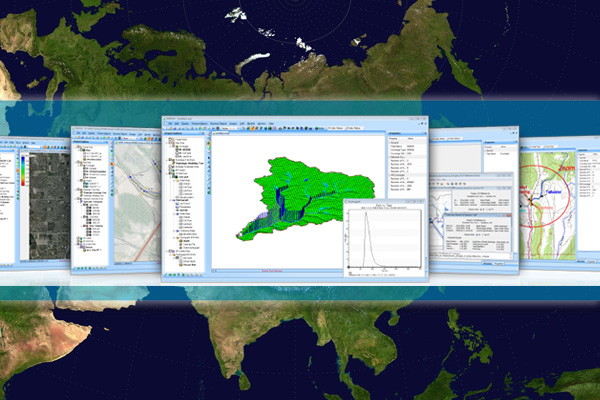
TerrSet 地理空间监测与建模软件
TerrSet是一个集成的地理空间软件系统,用于监测和建模地球系统的可持续发展。该TerrSet系统集成了IDRISI GIS分析和IDRISI图像处理工具以及一系列垂直应用。TerrSet提供了业界范围广的地理空间工具集,且价格低廉。没有必要购买昂贵的附加组件来扩展您的研究能力。
TerrSet软件功能
•IDRISI GIS分析
IDRISI GIS工具集提供了300多种分析工具,主要面向光栅数据,用于操作地理空间数据集,以探索我们快速变化的世界。
•IDRISI图像处理
TerrSet 的IDRISI图像处理系统是一套广泛的遥感图像恢复、增强、变换和分类的系统。
•土地变化模型
土地变化模型(LCM)是一种创新的土地规划和决策支持软件工具,用于土地变化分析和预测,具有REDD项目级建模的功能。
•栖息地和生物多样性模型
栖息地和生物多样性模型(HBM)是用于栖息地评估、景观格局分析和生物多样性建模的垂直应用程序。
•GeOSIRIS
GeOSIRIS是一个可以量化和绘制REDD项目对森林砍伐、碳排放、农业收入和碳支付影响的工具。
•生态系统服务建模
生态系统服务建模 (ESM)是一个用于评估自然资本对可持续发展价值的空间决策支持系统。
•**趋势模块
地球趋势建模器(ETM)是一套用于分析与地球观测遥感图像相关的图像时间序列数据的集成工具。
•气候变化适应模型
气候变化适应模型(CCAM)是一套用于建模未来气候,评估其对海平面上升、作物适宜性和物种分布影响的工具。
The Ecosystem Services Modeler (ESM) is a spatial decision support system for assessing the value of natural capital for sustainable development.
科学软件网不仅提供软件产品,更有多项附加服务免费提供,让您售后**!
http://turntech8843.b2b168.com