使用期限租赁和*
许可形式单机和网络版
原产地美国
介质下载
适用平台windows
科学软件网提供软件和培训服务已有19年,拥有丰富的经验,提供软件产品上千款,涵盖领域包括经管,仿真,地球地理,生物化学,工程科学,排版及网络管理等。同时还有的服务,现场培训+课程,以及本地化服务。
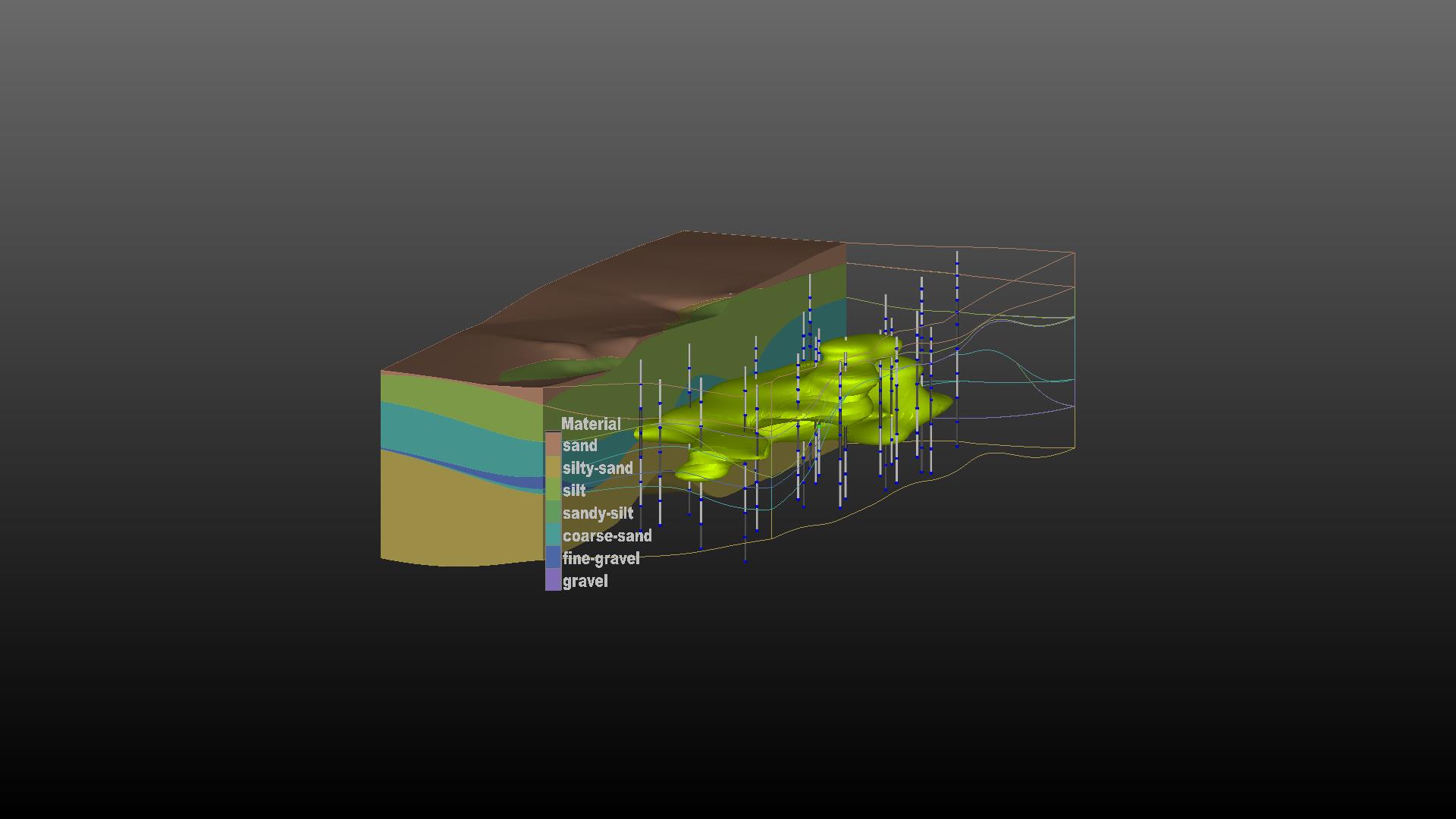
Mining Visualization System (MVS)是C Tech的分析和可视化的旗舰产品。MVS是从地面向地下和地表开采满足分析要求而设计的。然而,它所使用的工具也是土木和的环境建模。MVS EVS-PRO构建所有的功能,并增加了强大的新功能针对矿业的需求,满足规划师、土木、地质学家和环境苛刻的要求。
MVS的一些特的特性包括:3D断块代;矿体和羽流表土建模;隧道切割;矿井建模;许多额外的特性。

3D Parameter Estimation Using Expert System Driven Kriging
GS
Automatic 3D Adaptive Grid Refinement
GS/G Limited
Ability to Automatically Handle Time Domain Data
Compensation for Anisotropic Media Transmissivity
Environmental Visualization System (EVS Pro)是用于性分析,可视化和动画的早的产品。它包括网格模块,建模工具,输出选项,地质统计分析、 动画分析、GIS功能等。更多的功能还包括动画输出、实时地形漫游、地质结构建模、交互式分析、4DIM & VRML II 输出;ODBC数据库链接等。
EVS Pro的渲染提供了显著、完整的三维可视化技术以对污染的状况进行充分分析和可视化。
C Tech’s Earth Volumetric Studio is the world’s leading three-dimensional volumetric Earth Science software system developed to address the needs of all Earth science disciplines. Studio is the culmination of C Tech’s 29 years of 3D modeling development, building upon the developments of EVS-Pro, MVS and EnterVol. Studio’s customizable toolkit is targeted at geologists, environmental engineers, geochemists, geophysicists, mining engineers, civil engineers and oceanic scientists. Whether your project is a corner gas station with leaking underground fuel tanks, a geophysics survey of a large earthen dam, combining 3D resistivity and magnetics data, or modeling of salt domes and solution mined caverns for the U.S. Strategic Petroleum Reserves, C Tech’s Earth Volumetric Studio has the speed and functionality to address your most challenging tasks. Our software is used by organizations worldwide to analyze all types of analyte and geophysical data in any environment (e.g. soil, groundwater, surface water, air, etc.).

More complex gridding capabilities are available in EnterVol Geology©. When both EnterVol GeoStats and EnterVol Geology are installed on the same system, 3D estimation into geologic models is possible.
19年来,公司始终秉承、专注、专心的发展理念,厚积薄发,积累了大量的人才、技术以及行业经验,在行业内得到了大量用户的认可和高度价。
http://turntech8843.b2b168.com